Enhance Your Photos with Geo-Tagging Camera
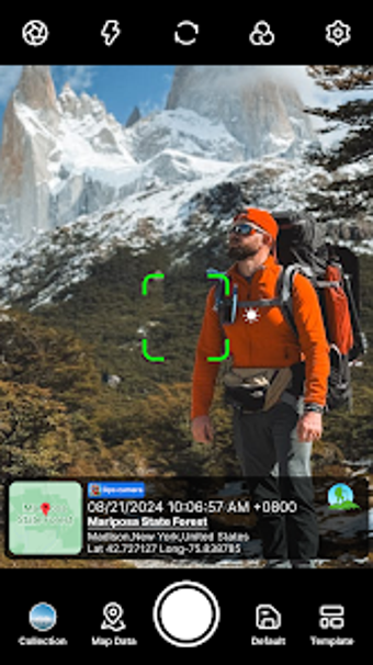
Geo-Tagging Camera is an Android application that allows users to enrich their photographs with detailed location information and environmental data. This multimedia app is particularly useful for travelers and professionals who want to document their experiences or construction site records. The app automatically fetches geotag details, including date, time, and weather, while also offering the option to set photo map data manually or automatically. Users can customize the camera settings with features like grid, ratio, flash, and filters, ensuring high-quality images with added contextual information.
The app provides extensive options for stamping photos with various data fields, such as map types, logos, timestamps, GPS coordinates, and weather conditions. Users can adjust the appearance of stamps with customizable font styles, colors, sizes, and positions. With features like automatic altitude measurement, wind speed, humidity, and more, Geo-Tagging Camera serves as a comprehensive tool for enhancing photography. Its user-friendly interface makes it easy to capture and save memories with precise location details.